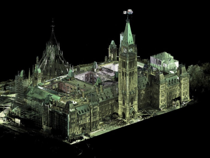
Creating a digital model of the National Capital RegionCanada’s National Capital Region is a whole lot bigger than most metropolitan areas. At nearly 5,000 square kilometres, it’s almost as large as Prince Edward Island. The National Capital Commission (NCC) owns more than 11 per cent of that land.
It’s responsible for 1,700 properties, including major green spaces like Gatineau Park, iconic public spaces like the Rideau Canal skate way, and hundreds of heritage buildings. Those properties are spread through the cities of Ottawa and Gatineau. Some are centrally located, others are inconspicuously tucked away in the greenbelt. To better visualize and manage their diverse property portfolio, the NCC has teamed up with the Carleton Immersive Media Studio (CIMS). Click here to read full text |
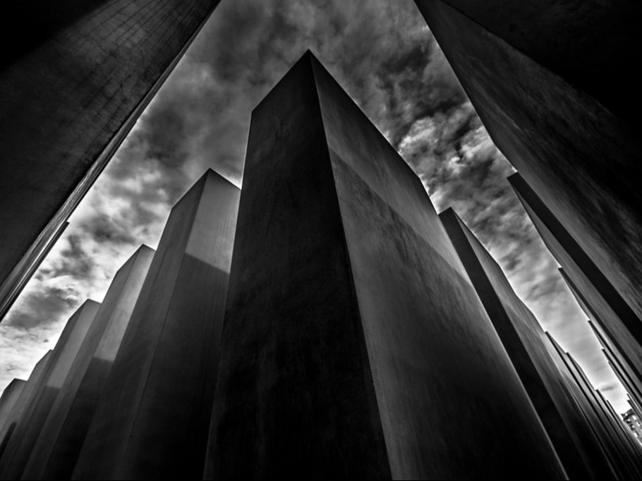
Memorializing historical trauma in cities' design and monumentsSteps from the Brandenburg Gate, at the symbolic heart of modern Germany, the Memorial to the Murdered Jews of Europe envelops visitors in a discomfiting grey.
It’s the dominant tone of the patio stones underfoot, the oft-overcast sky above, and 2,711 slabs of concrete that extend unevenly in every direction. Their drab featurelessness is inadequate to convey the ineffability of the lives they represent, even with rainfall beading on the smooth film of their anti-grafitti coating like countless tears shed for millions of lives cut short by pogroms, massacres and the Holocaust. It’s unsettling. And it’s supposed to be. Germany’s darkest hour hasn’t only been commemorated at the centre of its contemporary democracy, it’s been preserved at sites throughout the country. Click here to read full text |
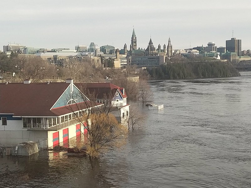
Upgrading infrastructure to cope with increased rainfallWhen it rains, it pours. And that, in a nutshell, is the problem.
When stormy weather rolls into Ottawa, the city’s wastewater infrastructure is swamped by the deluge. Impermeable surfaces like pavement prevent soil from absorbing water. With increased water volume, the flow picks up pesticides, animal waste and other pollutants as it rushes through the city’s 2,600 kilometres of storm sewers, pouring pollutants into Ottawa’s two glorious rivers: the Rideau and the Ottawa. City beaches close due to high counts of E. coli. Waterfront properties erode. Aquatic wildlife is killed off by contaminants and the runoff’s warmer temperature. Click here to read full text |
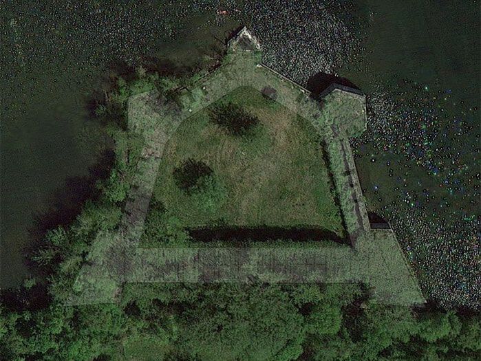
Abandoned 19th century fort languishes in jurisdictional messIt isn’t at all ordinary for a fortress to come up for sale, but then, Fort Montgomery is no ordinary fortress. That it guards the world’s longest undefended border is just the first of this quirky property’s paradoxes.
“The fort has been in private hands since it was auctioned by the U.S. government in 1929,” says Jim Millard, a historian who has advocated for the fort’s preservation for more than a decade. “And it’s been put up for sale many times over the years, but the last big burst of publicity came when the owners put it on eBay in 2006.” Click here for full text |

Local children consulted on development vision for futureIt sits on more than six acres of prime real estate just minutes from downtown, but the Booth Street complex is vacant – for now.
The red brick buildings were once home to the Department of Mines and Energy – a predecessor to Natural Resources Canada, but the site has been owned by the federal government's Canada Lands Corporation since 2015. They're planning to redevelop it, preserving several heritage buildings while razing others to make way for modern buildings and public spaces. Click here for full text |
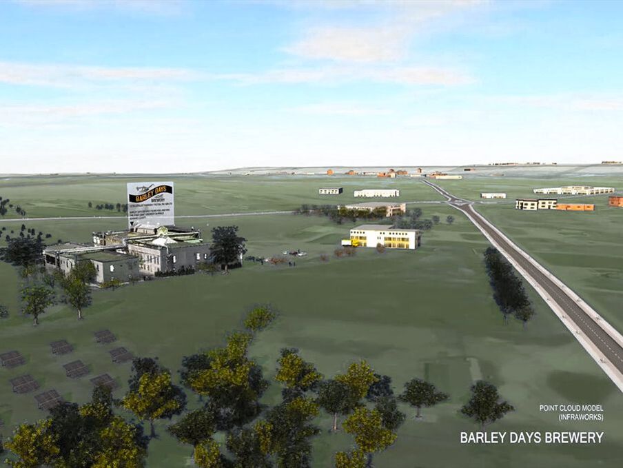
Mapping an entire region's economic systemsThe Carleton Immersive Media Studio (CIMS) has digitized King Tut's tomb and Morocco's kasbahs, but that’s nothing compared to what they’ve got on tap.
Using a combination of terrestrial laser scanning, building information modelling and open-source data, CIMS is creating a hyper-realistic 3D model of eastern Ontario that will put the region’s entire economic activity at the fingertips of the Ontario East Economic Development Commission. And like so many stories do, this one begins with beer. Click here for full text |